At the north-eastern tip of Tenerife, the Anaga mountains rise steeply out of the sea in a tangle of ridges and ravines. The tops are covered in laurisilva, a humid laurel forest kept alive by the trade-wind clouds, and the valleys hide small villages, terraced fields and black-sand coves. It's a different island from the sunny south — and only 20 minutes from La Laguna.
Anaga is a protected Rural Park and, since 2015, a UNESCO Biosphere Reserve. People still live and farm here, so it's not a wilderness, but it is some of the best hiking in the Canary Islands. This guide covers the forest walks at Cruz del Carmen, five of the best trails, the villages worth stopping in and the access rules that are changing. For more corners of the island, see our Tenerife hidden gems.
Quick Guide: Where to Start
Six ways into Anaga, from a short forest stroll to a full day on the coast.
Easiest Forest Walk
Short loops through the laurel forest at Cruz del Carmen.
Most Remote
The lighthouse and hamlet at the very end of the island.
Without a Car
A guided day with pick-up and the main viewpoints.
The Trails at a Glance
| Trail | Distance | Time | Type | Level |
|---|---|---|---|---|
| Sendero de los Sentidos | 0.3–1.3 km | 15–60 min | Loops | Easy |
| Cruz del Carmen – Punta del Hidalgo (PR-TF 10) | 10.4 km | ~4 h | One way | Moderate |
| Afur – Taganana – Afur (PR-TF 8) | 14.3 km | ~7 h | Circular | Hard |
| Benijo – Chamorga – Faro de Anaga (PR-TF 6) | 14.2 km | ~7 h | Circular | Hard |
| El Pijaral | Varies | Half day | Permit only | Moderate |
Distances and times are taken from the official trail information and are approximate. Paths in Anaga are steep, often muddy and can be closed after storms or rockfalls — check conditions with the Cruz del Carmen visitor centre before long walks.
Why Anaga Is Special
The laurel forest on Anaga's ridges is a living relic: millions of years ago, similar subtropical forests covered much of southern Europe and North Africa, and today they survive only on a few Atlantic islands. Laurel, til and other evergreen trees grow close together, draped in moss and ferns, and the clouds that roll in from the north-east keep them wet even when it hasn't rained. On a misty morning the forest is cool, quiet and a little eerie.
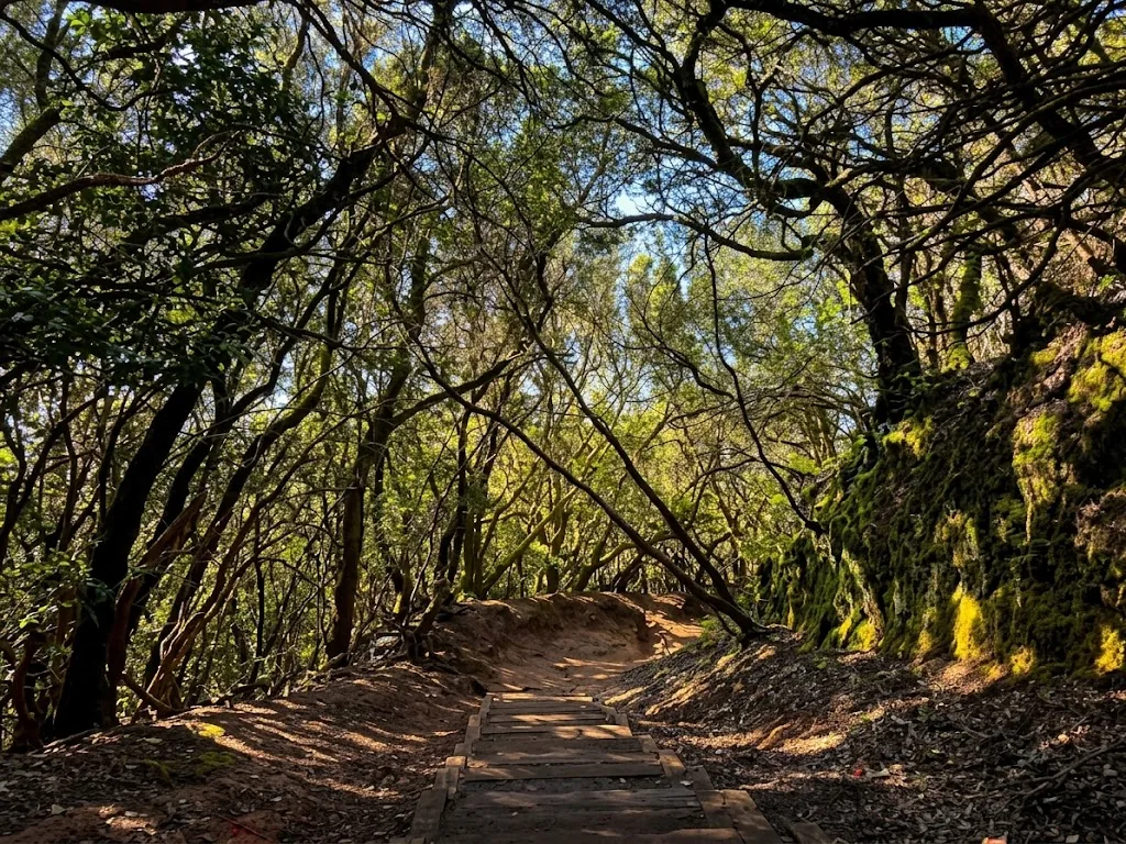
Listen for the Canarian chiffchaff in the canopy, and keep an eye out for the two laurel-forest pigeons found only in the Canary Islands, Bolle's pigeon and the laurel pigeon. Below the forest, the slopes turn dry and rocky, with cardón and tabaiba close to the sea. Stay on the paths, don't pick plants, and take your rubbish with you — Anaga is a protected area, and also somebody's farm.
The Best Trails in Anaga
I. Sendero de los Sentidos, Cruz del Carmen
The best introduction to Anaga starts at the Cruz del Carmen visitor centre, on the TF-12 ridge road above La Laguna. The Sendero de los Sentidos ("trail of the senses") has three short loops through the laurel forest, with signs inviting you to touch, smell and listen: the first is about 340 metres on boardwalk, suitable for pushchairs and wheelchairs; the second about 550 metres; and the longest about 1.3 kilometres, taking in the Llano de los Loros viewpoint. Allow up to an hour. Next to the centre, the Mirador de Cruz del Carmen looks over the Aguere valley to La Laguna and, on clear days, to Teide.
II. Cruz del Carmen – Chinamada – Punta del Hidalgo (PR-TF 10)
Anaga's classic hike goes from the forest to the sea. The PR-TF 10 starts beside the Cruz del Carmen restaurant, descends through laurel forest to the village of Las Carboneras, then follows the ridge to Chinamada, a hamlet of cave homes dug into the rock. The last stretch is a path cut into the cliffs above the Atlantic, ending at Punta del Hidalgo. It's about 10.4 kilometres and four hours, mostly downhill — roughly 1,300 metres down and 420 metres up — so it's hard on the knees, and poles help. It's one way: buses run from Punta del Hidalgo back to La Laguna, where you can connect to Cruz del Carmen.
Short of time? You can drive to Chinamada on a narrow road with very little parking, or walk just the section from Las Carboneras. Restaurante La Cueva, inside a cave house, serves simple Canarian food — check its opening days before you count on lunch.
III. Afur – Taganana – Afur (PR-TF 8)
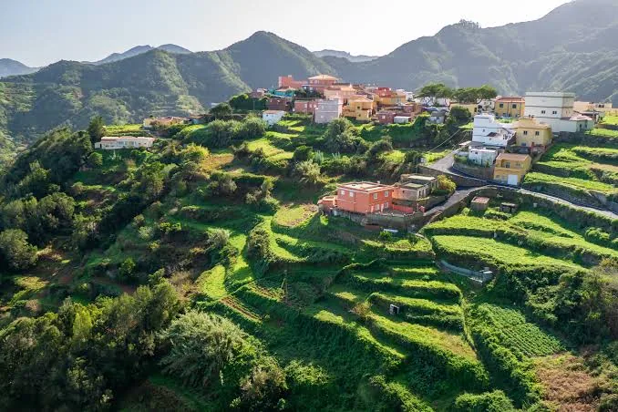
For many hikers this is the most beautiful route in Anaga. From the tiny village of Afur, the trail follows the Afur ravine almost down to the wild beach of Tamadite, then climbs over to the hamlet of El Chorro and Taganana, with its white houses and old church on a steep green slope. The return crosses the Las Vueltas woodland and the Inchirés path back to Afur. It's a circular walk of about 14.3 kilometres and seven hours, with more than 1,500 metres of climbing, so start early, carry plenty of water and check the weather — the ravine is no place to be after heavy rain.
IV. Benijo – El Draguillo – Chamorga – Faro de Anaga (PR-TF 6)
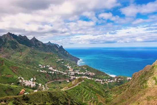
This is the end of Tenerife. From Benijo, a flat track runs along the coast to the hamlet of El Draguillo, about half an hour away; from there the path climbs over the ridge to Chamorga, the last village at the end of the road, and continues to the Faro de Anaga lighthouse and the tiny settlement of Roque Bermejo on the sea, before climbing back. The full circuit is about 14.2 kilometres and seven hours, with over 1,400 metres of ascent. Sections have been damaged by landslides in recent years, so ask at Cruz del Carmen before you set off. Bring your own food: the bar in Chamorga is not always open.
If you're short of time, the walk from Benijo to El Draguillo and back is flat and easy, or you can start from Chamorga and walk just to the lighthouse and Roque Bermejo.
V. El Pijaral, the "Enchanted Forest"
The Sendero del Bosque Encantado passes through El Pijaral, a strictly protected zone with some of the best-preserved laurel forest in the park: twisted trunks, carpets of moss and huge ferns. To protect it, access is limited to 45 people a day, and you need a free permit from the Cabildo de Tenerife, requested online up to 15 days in advance. Places go quickly at weekends, so book as soon as your dates are fixed, and bring your permit and ID on the day.
Villages and Beaches
Taganana
One of the oldest settlements on the island, Taganana is a village of white houses on terraced slopes, reached by a road that drops through a tunnel from the ridge at El Bailadero. Walk up to the church, then head down to the coast at Roque de las Bodegas and Almáciga, where fish restaurants serve the catch of the day. Line 946 from Santa Cruz serves the village.
Playa de Benijo and Roque de las Bodegas
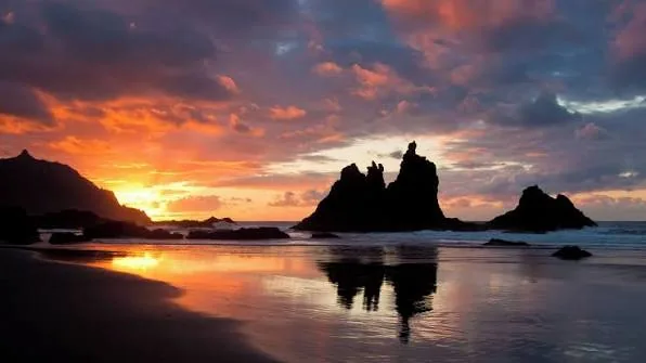
Benijo is a wild beach of black sand facing the Roques de Anaga, sea stacks that glow at sunset. Park by the restaurant at the top and walk down. There are no sunbeds or lifeguards, and the swell can be strong, so swim only on calm days. Nearby Roque de las Bodegas has a small beach reached by steps from the car park, and a few restaurants by the water.
Viewpoints on the Ridge Road
The TF-12 runs along the spine of Anaga with viewpoints at every turn. The best include Cruz del Carmen, the Pico del Inglés, looking down over the ravines to Santa Cruz, and El Bailadero, where the cloud often spills over the pass. Go early: by midday the ridge is frequently in cloud.
Getting There and Access Rules
By car, Cruz del Carmen is about 20 minutes from La Laguna on the TF-12, and Taganana and Benijo about 30 to 40 minutes from Santa Cruz. The roads are narrow, with tight bends; drive slowly and use the viewpoints to let locals pass. Car parks at Cruz del Carmen and at the main trailheads fill quickly at weekends, so arrive early.
By bus, TITSA lines 076 and 275 stop at Cruz del Carmen, coming from La Laguna, and line 946 runs from Santa Cruz to Taganana and Benijo. Services are infrequent, especially at weekends, so check return times before you set off. Tenerife North airport is the closest to the park.
Changes are coming. To ease traffic and protect the park, the Cabildo de Tenerife has announced that hikers will pay an access fee and use shuttle buses from 2027, along with a ban on vehicles more than ten metres long. As of October 2026 these measures are not yet in force and the details have not been published, so check the latest rules before your trip — we'll update this guide when they are confirmed.
Where to Stay
There are only a few small rural houses inside the park, so most visitors stay in Santa Cruz or La Laguna, both less than half an hour from the trails. Staying in the north-east also saves the long drive from the southern resorts. For more choice, see our best hotels in Tenerife North guide.
Apartamentos Bruja, Santa Cruz de Tenerife
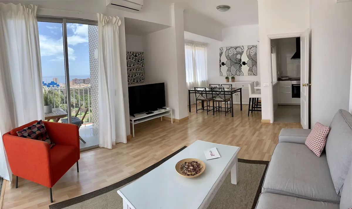
Bright, modern apartments near La Granja park in Santa Cruz, with full kitchens, a washing machine and a rooftop terrace; some units have sea views from the balcony. It's a practical base for Taganana and Benijo, and the city has plenty of restaurants for the evening. There's no parking on site, which is the main drawback if you have a car.
Apartamentos Bruja
Apartments with kitchens and a rooftop terrace, closest to Taganana and Benijo — from around €95.
La Laguna Gran Hotel
A modern hotel in the UNESCO old town, 20 minutes from Cruz del Carmen — from around €105.
Practical Tips
Start Early
Cloud usually builds over the ridges by midday, and car parks fill quickly at weekends.
Dress for Mist
The forest is cooler and wetter than the coast. Bring a warm layer and a waterproof, even in summer.
Good Shoes
Paths are steep, rocky and slippery with mud and roots. Hiking boots and poles make a big difference.
Check Conditions
Trails close after storms and rockfalls. Ask at Cruz del Carmen or check with the Cabildo before long routes.
Food and Water
Village bars keep irregular hours. Carry water and something to eat on every hike.
Staying Connected
Signal drops in the ravines. Download your route offline, and a Yesim eSIM keeps you online on the ridge.
Frequently Asked Questions
Final Verdict
With one day, drive to Cruz del Carmen early for the Sendero de los Sentidos and the viewpoints, continue over the mountains to Taganana for a fish lunch and finish with sunset at Benijo. With two, give a full day to the PR-TF 10 to Chinamada and Punta del Hidalgo, or the Afur–Taganana loop if you're fit. Book El Pijaral ahead if you want the forest at its best, keep an eye on the new access rules, and go early — Anaga is at its most magical before the cloud and the crowds arrive.